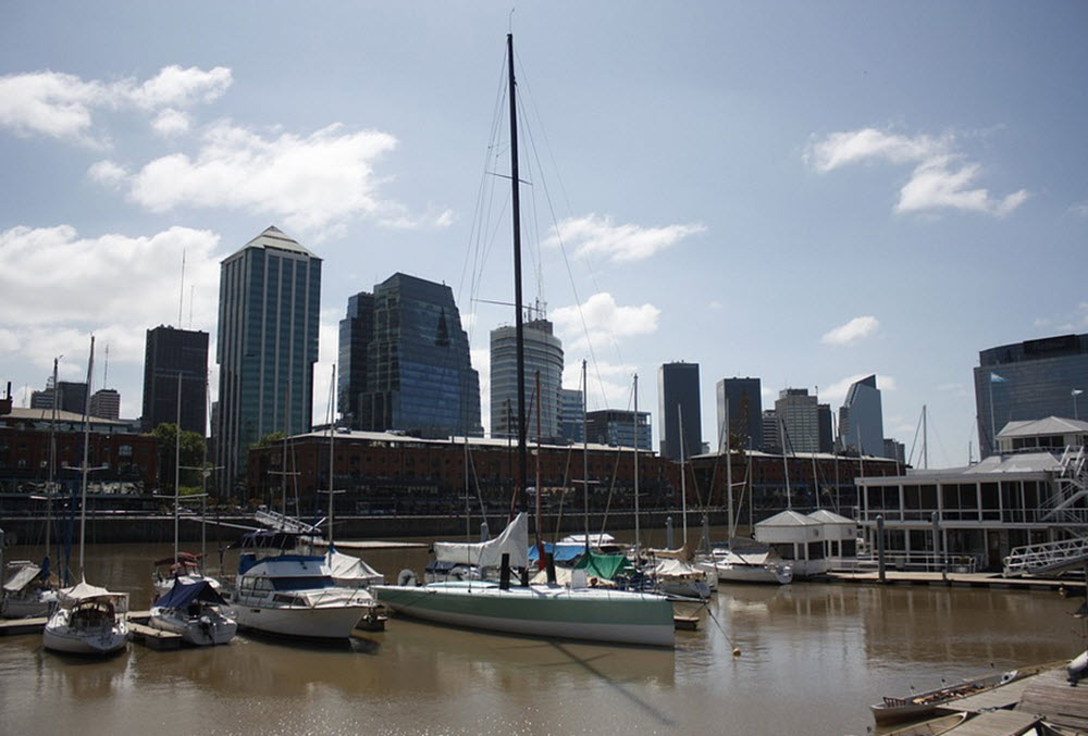
The Río de la Plata is a large estuary formed by the confluence of the Paraná and Uruguay rivers between Argentina and Uruguay. In Spanish, the name Río de la Plata roughly translates into Silver River or River of the Silver. In English, it is sometimes called the River Plate.
This is one of the largest estuaries in the world, serving as a crucial natural boundary and a major shipping route that has played a vital role in the history and economy of the Southern Cone of South America. Río de la Plata is a vital natural feature, with profound historical, economic, and ecological significance for Argentina and Uruguay.
The northern shore of Río de la Plata belongs to Uruguay, with Montevideo, the country’s capital and largest city, located along its banks. The southern shore is part of Argentina, with Buenos Aires, the capital and largest city of Argentina, situated near the estuary’s western end. The Río de la Plata thus serves as a significant geographical feature for both countries.
Its wide expanse and strategic location have made Río de la Plata a central figure in the region’s development, serving as a lifeline for commerce, a boundary between nations, and a habitat for a diverse array of life. As efforts continue to preserve its environmental health, the Río de la Plata remains a symbol of the natural beauty and cultural heritage of the Southern Cone.

Geography
Río de la Plata begins at the confluence of the Paraná and Uruguay rivers, at the border between Argentina and Uruguay. From there, it flows eastward into the Atlantic Ocean. The estuary is approximately 290 kilometers (180 miles) long and varies in width from about 40 kilometers (25 miles) near its western end to approximately 220 kilometers (137 miles) at its mouth, making it the widest river in the world at the point where it empties into the ocean.
Río de la Plata is generally spoke of as a river or river estaury, but some experts argue that it is actually a large bay or marginal sea of the Atlantic Ocean.
Islands
The upper part of Río de la Plata contains several islands, including Oyarvide Island and the Solís Islands (in Argentina) and Juncal Island, Islote el Matón, Martín García Island and Timoteo Domínguez Island (in Uruguaya).
The islands in Río de la Plata have a tendency to grow over time, since sediments carried by the river gets deposited around them.
Barra del Indio
The submerged shoal Barra del Indio is considered the marking spot where the inner freshwater riverine portion ends and the outer brackish portion starts. The shoal is found between Montevideo and Punta Piedras.
In the inner riverine zone, the dept varies from circa 1 to 5 meters. The outer brackish zone gets gradually deeper, from 5 meters to 25 meters.
History
The first European power to explore the Río de la Plata region Portugal, who did so in 1512-1513. At this point, nomadic Native American peoples had already inhabited the region for thousands of years, and many of the people who live near Río de la Plata today are descendants of them. The first Spanish exploration of the region occured in 1516, when Juan Díaz Solís visisted during his search for a passage from the Atlantic to the Pacific Ocean.
The Río de la Plata became a site of international strategic importance during the time of European exploration and colonization in the 16th century. It was a key route for Spanish ships transporting silver and other goods from the mines of Potosí in present-day Bolivia, which is how the river got its name (“River of the Silver” in Spanish).
Throughout the colonial period and after independence, the estuary remained a vital commercial and military route, shaping the economic and political development of the region.
Economic role
Today, the Río de la Plata remains a critical artery for international trade and transportation. The ports along its shores, particularly Buenos Aires and Montevideo, are among the busiest in South America, handling a significant portion of the continent’s sea-borne cargo. The estuary’s waters are also used for fishing, tourism, and recreational activities, contributing to the local economies of Argentina and Uruguay.
Ecological significance and environmental challenges
The Río de la Plata estuary is a critical habitat for a diverse range of flora and fauna, including many species of birds, fish, and plants. Its freshwater and marine ecosystems support significant biodiversity and provide crucial breeding and feeding grounds for various species. The estuary also plays a vital role in the region’s climate and hydrology, influencing weather patterns and serving as a major source of freshwater.
The Río de la Plata faces several environmental challenges, including pollution from industrial and agricultural runoff, overfishing, and habitat destruction. Efforts are underway by both Argentina and Uruguay to address these issues, including initiatives to improve water quality, protect natural habitats, and promote sustainable development along the estuary.
